• HOME
  • ABOUT
  • AERIAL FILMING
  • LIGHT SHOWS
  • PHOTOGRAPHY
  • INDUSTRIAL
  • BROADCAST
  • CONTACT
  • العربية
  • CONTACT 2
  • HOME
  • ABOUT
  • AERIAL FILMING
  • LIGHT SHOWS
  • PHOTOGRAPHY
  • INDUSTRIAL
  • BROADCAST
  • CONTACT
  • العربية
  • CONTACT 2

Drones are revolutionizing the way we map and gather data for Digital Twins, 3D models and geo-referenced surveys. Working together with our partner Bentley Systems, we integrate professionally surveyed Ground Control Points into aerial survey data to produce models allowing for industrial measurements with sub-centimeter accuracy and GSD values of < 0.5mm / pixel.

Subscription 3D scans are an essential component of proactive site management workflows for consultants and contractors alike.  In addition to providing accurate spatial information to engineers, designers, architects and contractors, regular drone survey inspection saves time and money by identifying problems, minimizing costly reworks and providing evidence of supplier non-compliance with construction specifications.


DIGITAL TWINS / DRONE-BASED PHOTOGRAMMETRY

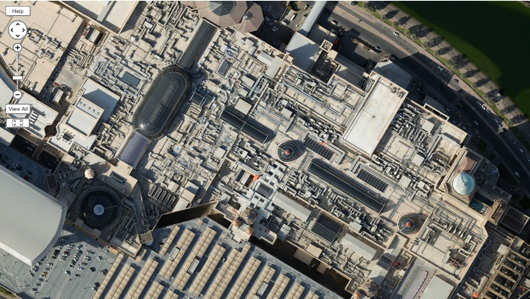
Drone-based 3D photogrammetry is a pioneering method of acquiring data for Digital Twin programs, architectural visualization, inspections and construction update imaging. Whereas 3D models produced in CAD / modeling software are projections of design, a reality model is a representation of reality. Having an accurate 3D model of the existing space or asset enables rapid design decision-making and provides a powerful visual aid for industrial measurements, compliance management, planning, asset longevity management and the exploration and presentation of architectural proposals. In addition, accurate 3D models are powerful inspection tools combining visual analysis with distance, area and volume calculations.

OUR SERVICES

  • DIGITAL TWINS – MADE WITH BENTLEY

  • HERITAGE MODELS

  • 3D REALITY MODELS / VISUALIZATION TOOLS

  • ELEVATION MODELS FOR VOLUMETRIC ANALYSIS: MINING / CUT & FILL PROJECTS

  • HIGH RESOLUTION ORTHORECTIFIED IMAGES FOR MAPPING AND LAND COVER CLASSIFICATION

ADVANTAGES OF DRONE INSPECTIONS

  • Cost-effectiveness – no requirement for scaffolding or access equipment. Minimal disruption and reduced safety concerns

  • Increased accuracy of tender briefs

  • Effective off-site analysis by surveyors, architects or specialists in remote locations

  • Complete documentation of existing as-built conditions – high resolution images and measurements save inspection time and costs

  • Compliance Management

To learn more about Workflows and Usages of 3D Surveys for Engineering and Site Management, DOWNLOAD our PDF Presentation HERE. 

We’re happy to learn about your project and find a cost-effective visualization solution for your Digital Twin program or your planning & site-management objectives.

Email
whatsapp
+971 56 162 5900
© 2022 Surface Aerials. All Rights Reserved.